HSC PDR2 includes over 300 square degrees of multi-band data at the nominal survey depth. See the figures below for the survey footprints. The blue and green areas show the Wide and Deep+UltraDeep layers, respectively. The darker blue regions are covered in more filters (max. 5).


The table on the right gives a quick overview of the quality of our data. The depths are given as 5 sigma limiting magnitudes for point sources. Our target exposures and depths are also shown for reference for each layer.


Data Retrieval
The data can be retrieved in multiple ways. The simplest way to retrieve catalog data is to use the database. We have online/offline SQL tools. For image data, most users will find hscMap, an online image browser, very useful. For binary files, we have a data search tool as well as image cutout tool. All these tools are summarized in the Data Access page. In order to access the data, you first have to sign up for an account. Before you use our data products, we strongly recommend you to go over the data release paper and the Known Problems page. If you use the HSC data in your publication, please acknowledge us. This site serves only the processed data. Raw data can be retrieved from SMOKA.
Data Quality
We have performed a number of validation tests for our data products. Details are described in the data release paper, but a complete set of the plots can be found here.
Known Problems
Although our data are of high quality, there are several known problems. We have a dedicated page to summarize them. Please check out the page before you use our data for your science.
Pipeline Products

All the files are available for download. However, detailed shape measurements (HSM shapes) are withheld from the release. The files shown in red are new/updated files from PDR1.
ICSRC: Catalog of bright sources detected and measured on a CCD, and used in astrometric and photometric calibration. (FITS BINTABLE)
SRC: Catalog of sources detected and measured on a CCD, output from the final stage of the single frame processing. See CALSRC, too. (FITS BINTABLE)
SRCMATCH: Source catalog (SRC) cross-matched with the external reference (PS1) sources. Identification numbers and separation angles in cross-matching are recorded for the external sources. (FITS BINTABLE)
SRCMATCHFULL: Another form of SRCMATCH, in which coordinates and fluxes of the external sources are explicitly listed (de-normalized) rather than listing the identification numbers only. (FITS BINTABLE)
CORR: CCD image with calibrated coordinates and magnitude zeropoint from the single frame processing. See CALEXP, too. (Muliti-extension FITS IMAGE + BINTABLE)
BKGD: Sky background model subtracted from a CCD image. (Multi-extension FITS IMAGE)
skyCorr: Residual pattern to be subtracted from a CORR image to get the global sky subtraction applied. (Multi-extension FITS IMAGE)
fcr: Contains flux scale and its positional variation of a CCD determined by mosaicing. (Multi-extension FITS)
wcs: The world coordinate system of a CCD determined by mosaicing. (Multi-extension FITS)
CALEXP: Corrected image (CORR) with the flux and WCS corrections from the internal calibration applied. (Muliti-extension FITS IMAGE + BINTABLE)
CALSRC: Source catalog (SRC) with the flux and WCS corrections from the internal calibration applied. (FITS BINTABLE)
photoCalib: Ignore.
det: List of source positions and footprints detected on a coadd patch. (FITS BINTABLE)
det_bkgd: Constant background subtracted in the object detection phase.
warp: Image of a single visit (CORR) transformed onto a destination tangential plane in a tract. (Multi-extension FITS IMAGE + BINTABLE)
psfMatchedWarp: warp image convolved to a common seeing. (Multi-extension FITS IMAGE + BINTABLE)
calexp: Coadd image in a single band, or resultant image from the Stack stage, which combines all the overlapped warp images. (Multi-extension FITS IMAGE + BINTABLE)
$(patch)_nImage: Image representing a number of visits contributed to each pixel in coaddition. (Multi-extension FITS Image)
$(patch): Coadd image in a single band right after the coaddition and before the source detection stage, in which sky background is slightly updated. (Multi-extension FITS IMAGE + BINTABLE)
mergeDet: Merged list of source positions and footprints from all filters in a coadd patch. (FITS BINTABLE)
meas: Single-band source catalog measured on each of sources in a coadd image listed in mergeDet. Peak positions and shapes of sources are determined in a band being measured. (FITS BINTABLE)
srcMatch: Single-band source catalog (meas) cross-matched with the external reference (PS1) sources. (FITS BINTABLE)
srcMatchFull: Another form of srcMatch. Coordinates and fluxes of the external sources are explicitly listed (de-normalized) in the same manner as in SRCMATCHFULL. (FITS BINTABLE)
ref: List of source positions and shapes determined by merging results of the single-band measurements (meas) in a coadd. Reference catalog used for the final forced measurement. (FITS BINTABLE)
forced_src: Source catalog from a multi-band measurement, which is performed on each of sources listed in the ref catalog. Positions and shapes are held fixed in the reference band in the measurements. Final catalog from the forced photometry. (FITS BINTABLE)
forced_src_undeblendedConvolved: Complementary flux measurements to forced_src, where aperture flux measurements without deblending on a convolved coadd image are listed. These measurements are loaded in forced5 table. Note that forced_src also lists the aperture flux measurements on a convolved image, but they are deblended. See the database page or schema browser, too. (FITS BINTABLE)
Additional Products
Objects around bright stars likely have bad photometry and these objects are flagged during the processing. Although this is a useful database flag, the size of the current mask is known to be too small and some stars are missing the mask. Refer to the Known Problem page details.
Incremental Release 1: revised masks are now available at the database!
For clustering analysis, a set of random points across the survey area will be useful. Such a collection of random points can be found in the database.
Incremental Release 3: The Deep and UltraDeep fields are observed in a few narrow-band filters in addition to the broad-band filters. These narrow-band filters allow us to detect emission line objects at some specific redshifts and the emission-line object catalog from Hayashi et al. 2020 is now publicly available.
Incremental Release 5: the galaxy density map from Shimakawa et al. 2021 is available in an electric format.
Incremental Release 7: A catalog of Lyman Break Galaxies (LBG) from Harikane et al. 2022 is available here.
Partly for the purpose of photo-z calibrations, we have collected public spectroscopic redshifts from the literature and the collection is matched to the HSC objects by position. Each spectroscopic survey has its own flagging scheme to indicate the redshift confidence and we have a homogenized flag for each object for easy selection of objects with reliable redshifts. It is important to emphasize that users should acknowledge the original data source(s) when using this table.
Weak-lesing data products from some of our papers (Oguri et al. 2018; Hikage et al. 2019; Shirasaki et al. 2019) are made publicly available as part of the incremental release 1.
Incremental Release 2: Photometric redshifts for PDR2 are now available!
Incremental Release 4: the UltraDeep COSMOS region has been observed in additional narrow/medium-band filters: N527, N718, IB945, N973. These filters are processed in conjunction with the SSP data and are now publicly available. Click the button above to go to the dedicated page.
Incremental Release 6: a cluster catalog based on CAMIRA, a multi-color red sequence cluster finder, is now available.
COSMOS stacks
The COSMOS field is one of the key extragalactic fields and is a valuable calibration field. Using subsample of the UltraDeep COSMOS data, we have generated three sets of Wide-depth stacks at 25, 50, and 75th percentile seeing for each band in the Wide layer. These sets will be useful for various systematic tests for the Wide layer.
S16A Shape Catalog
The detailed galaxy shape measurements withheld from PDR1 are now publicly available. Follow the link below for details.
Incremental Release 1: Weak-lesing value-added data products from our key papers (Oguri et al. 2018; Hikage et al. 2019; Shirasaki et al. 2019) are made publicly available as part of the incremental release 1.
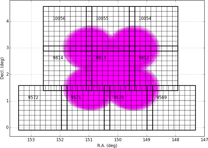
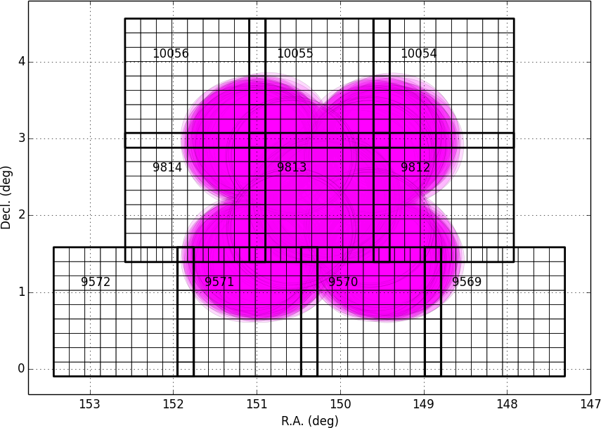
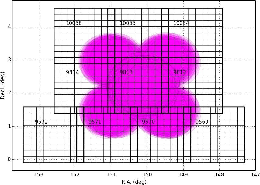
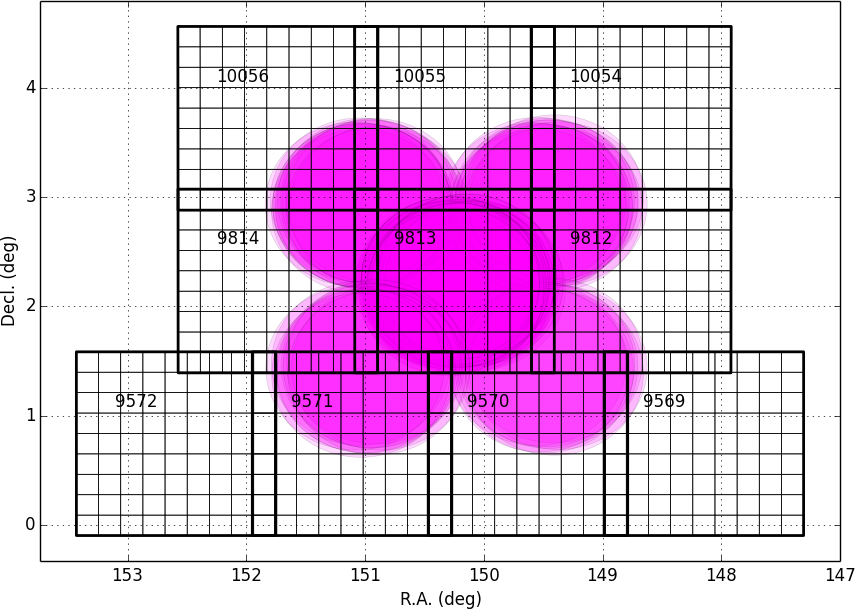
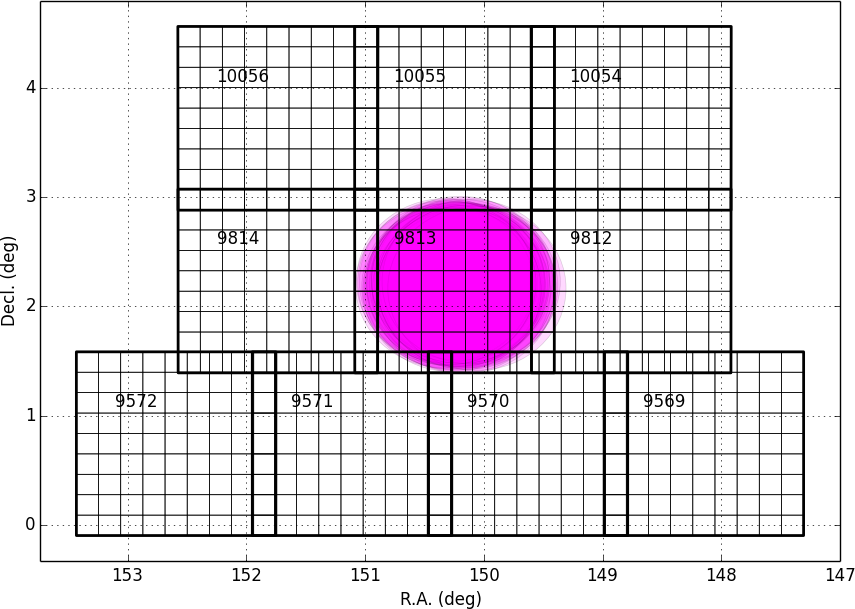
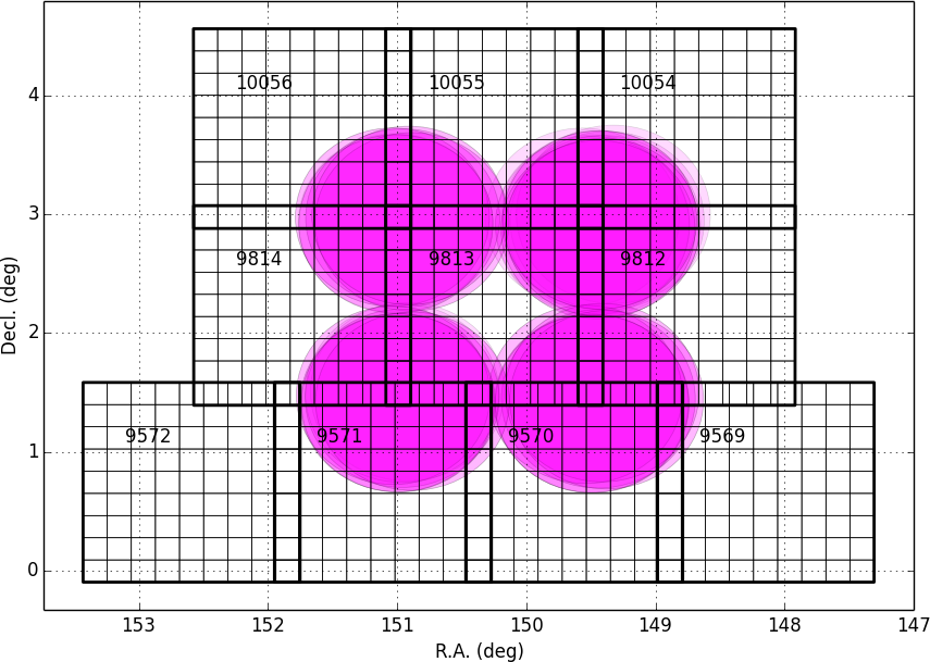
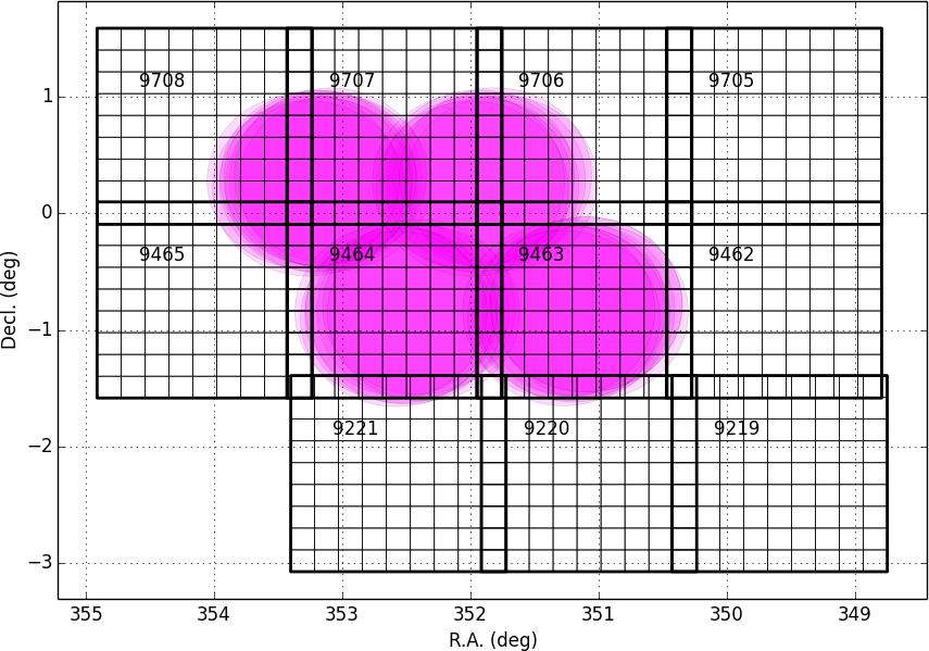
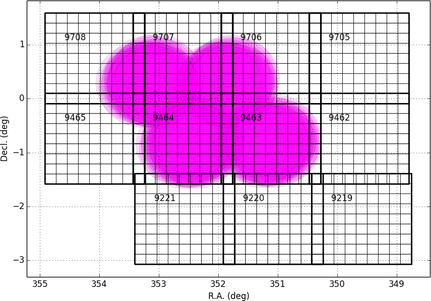
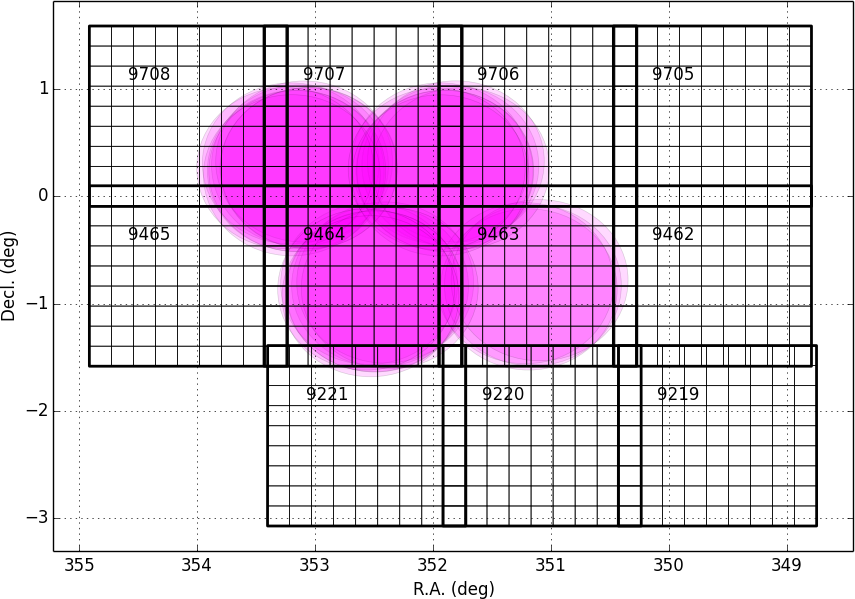
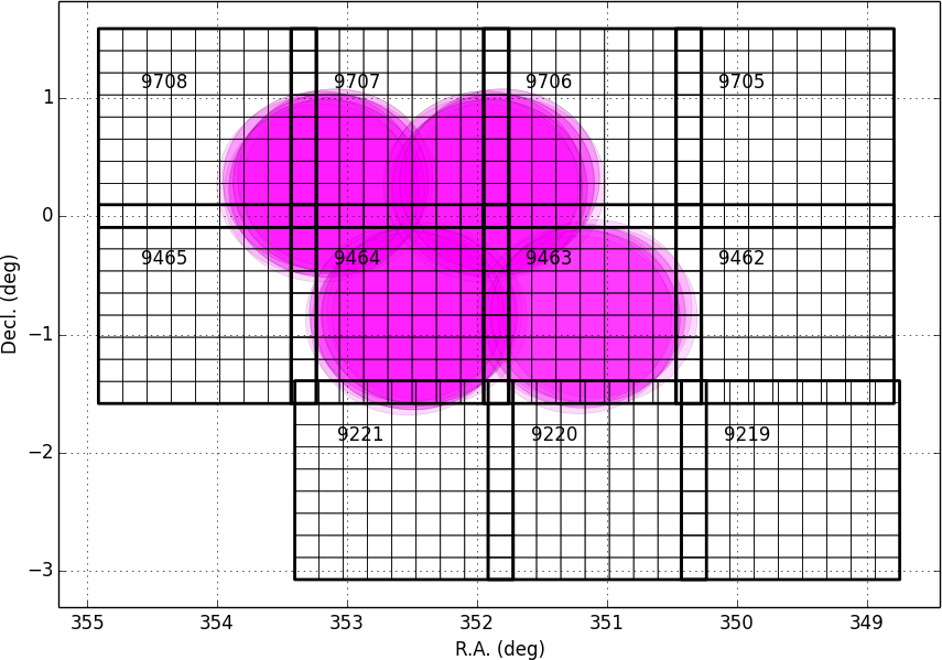
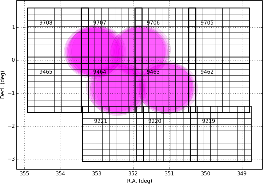
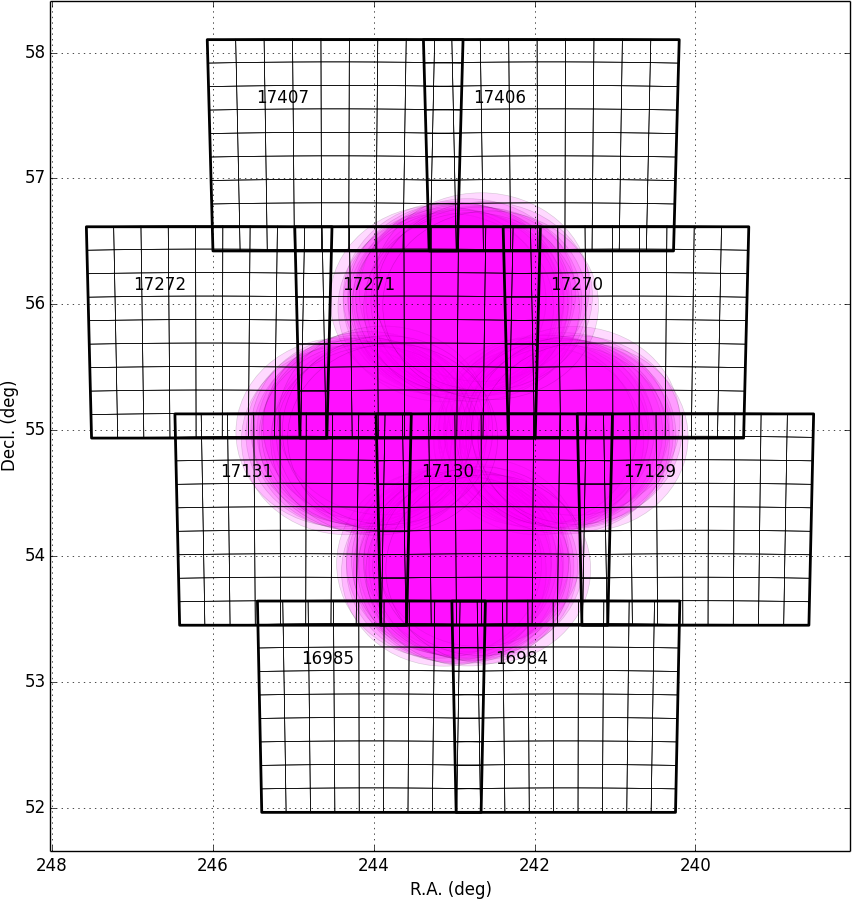
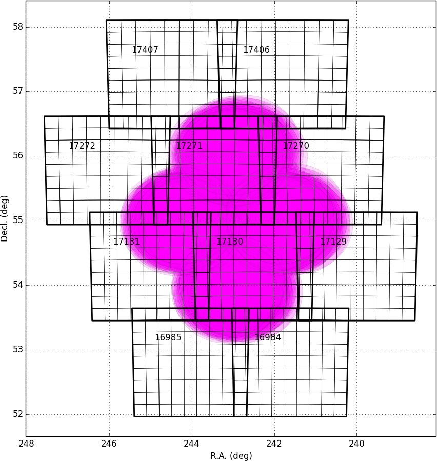
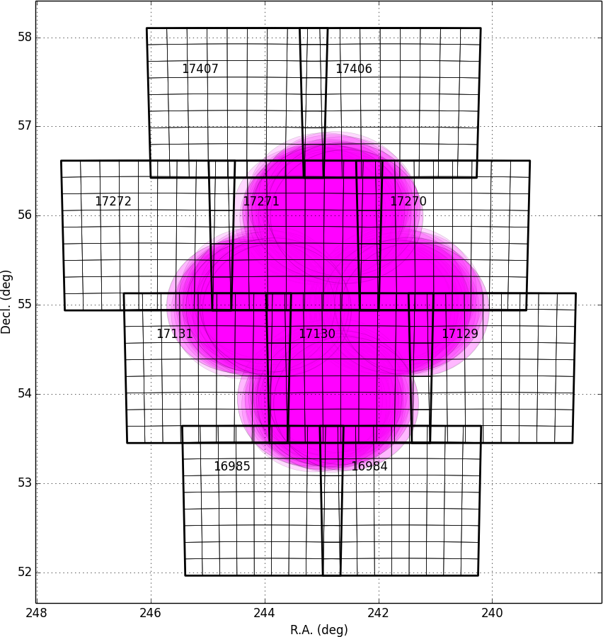
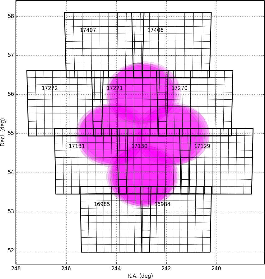
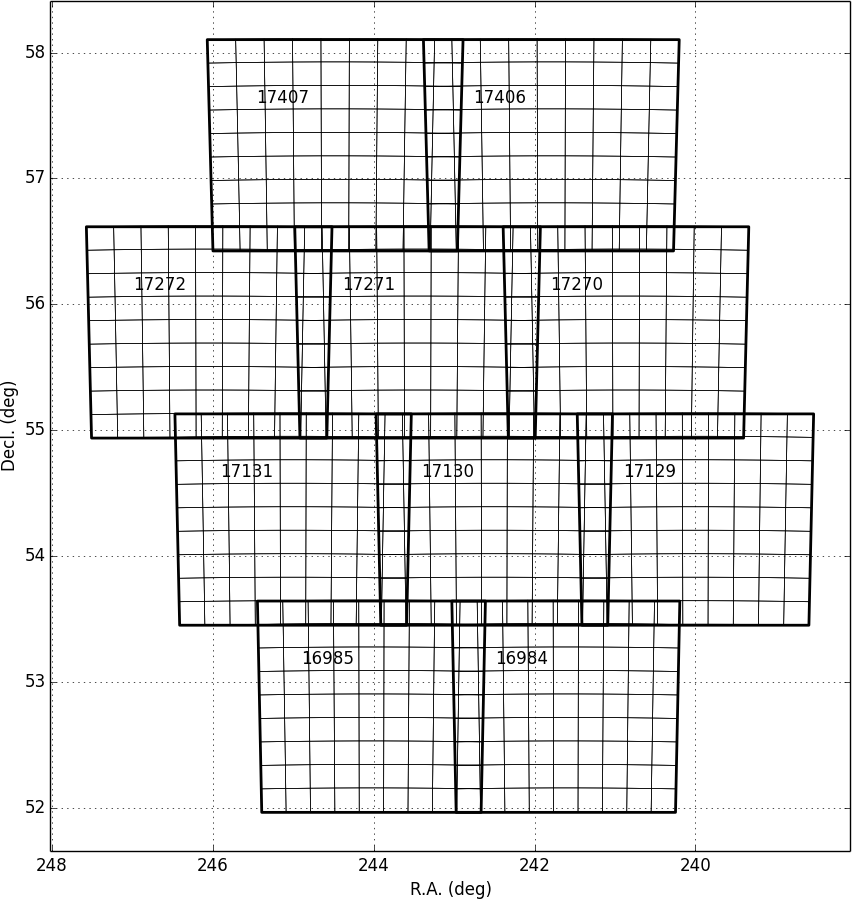
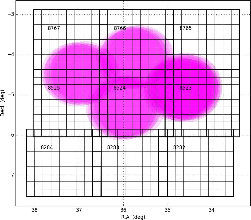
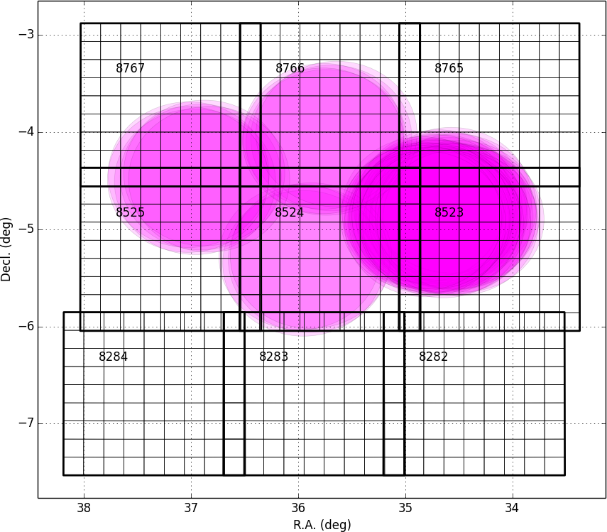
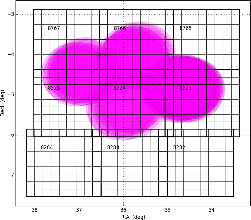
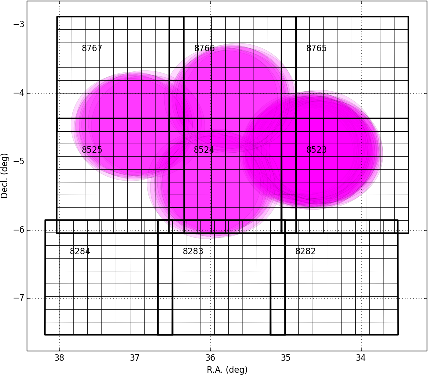
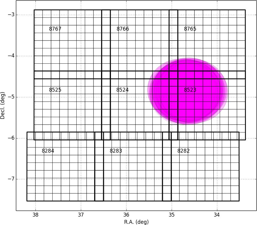
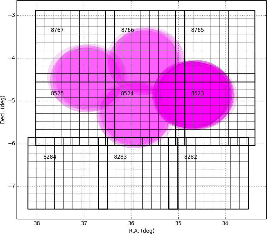
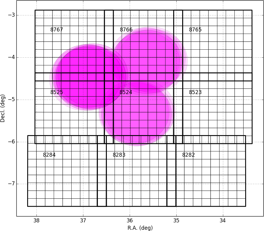
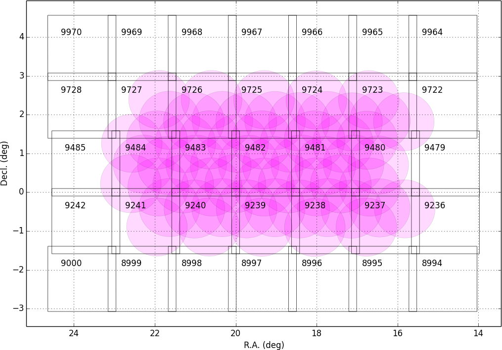
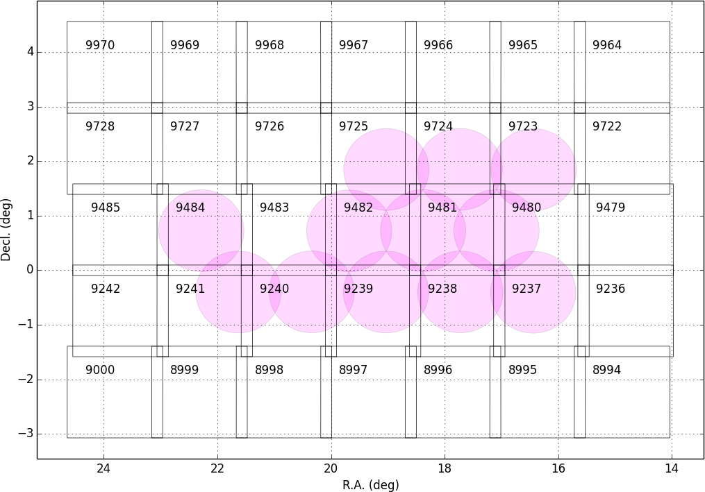
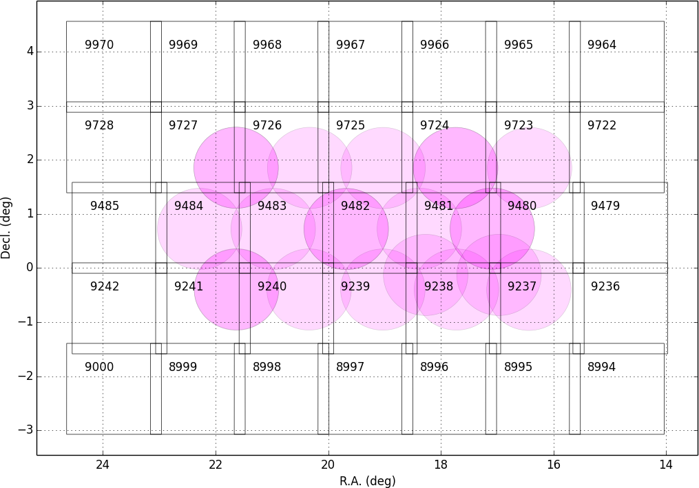
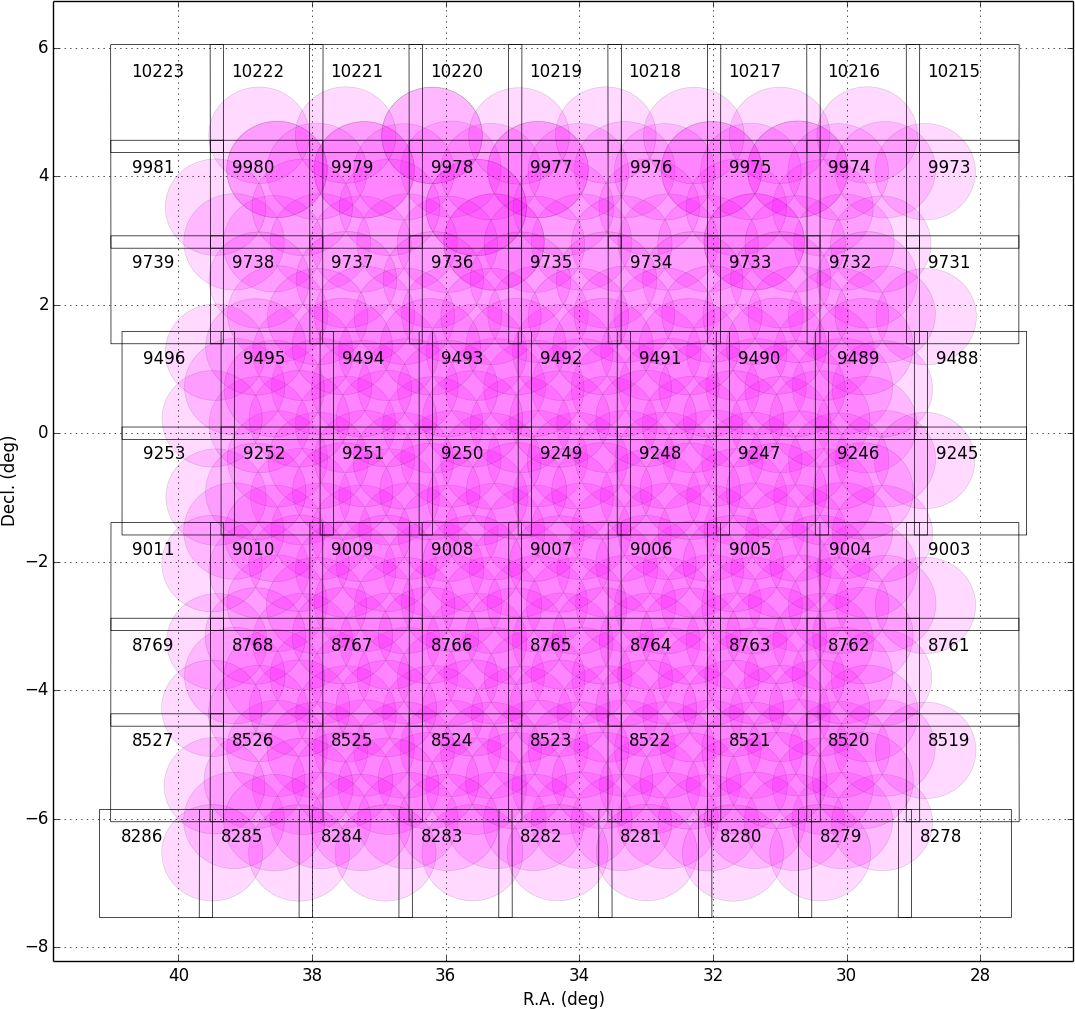
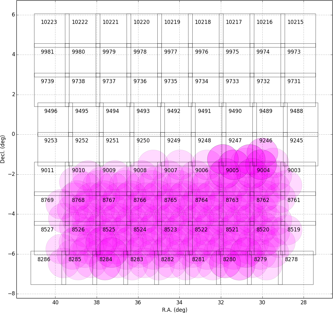
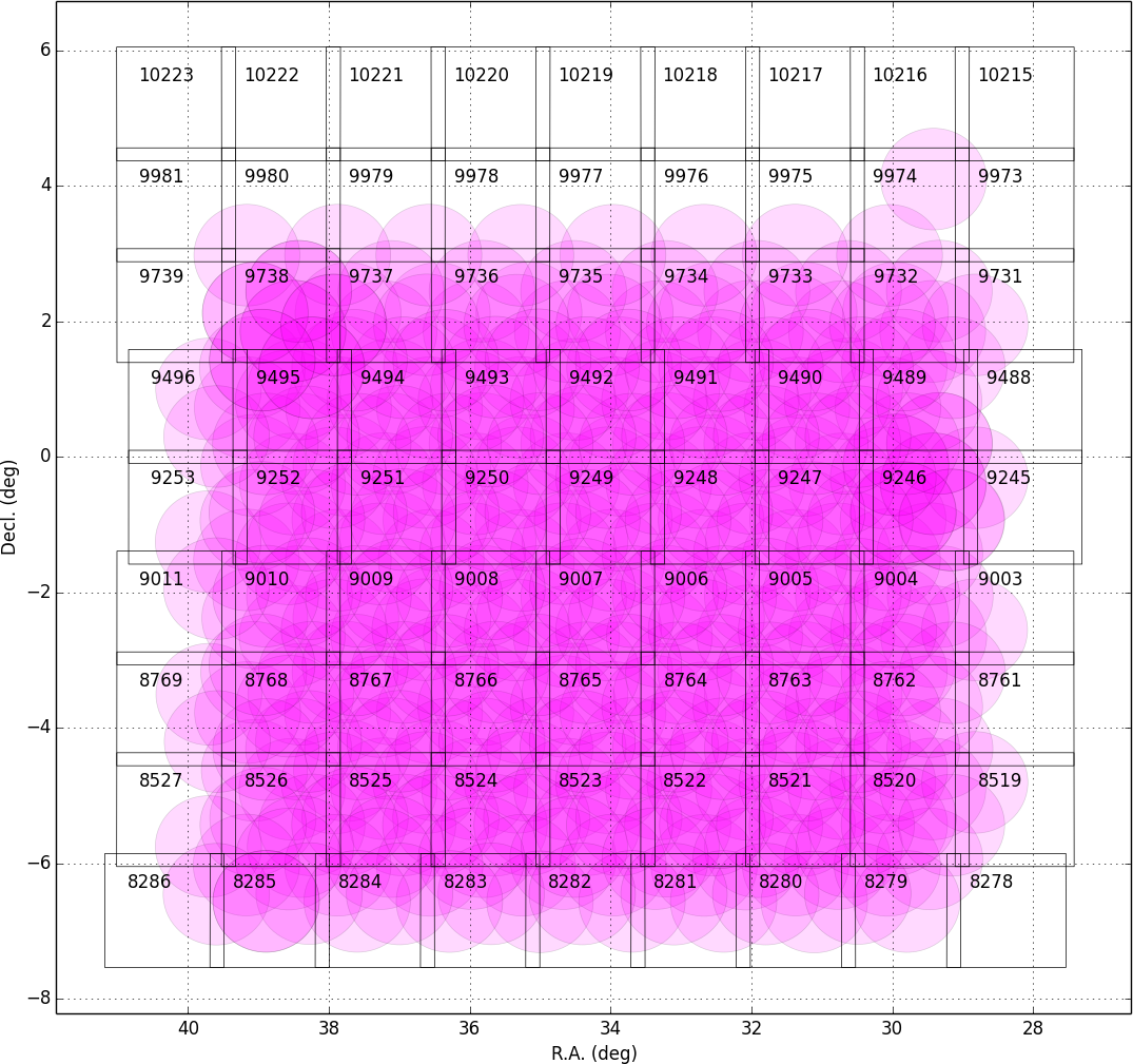
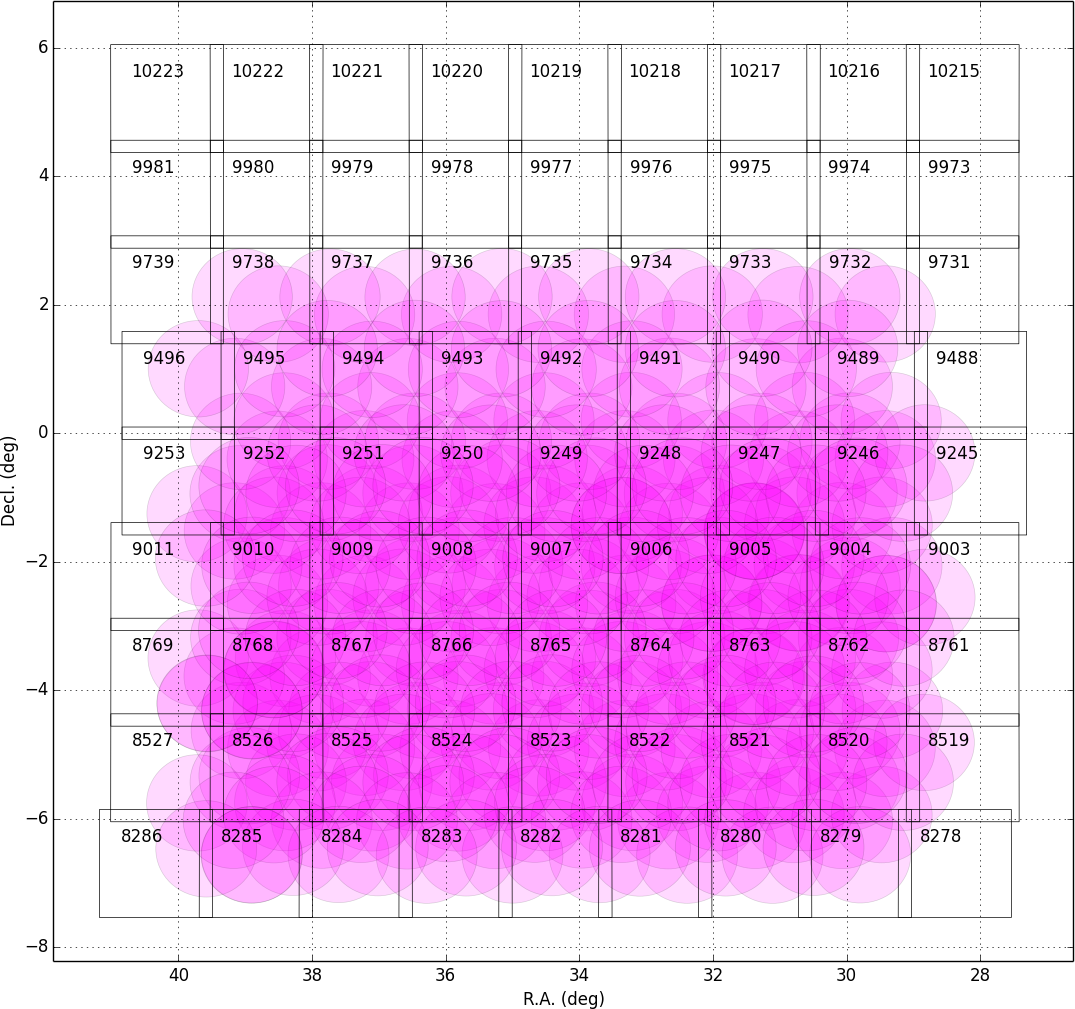
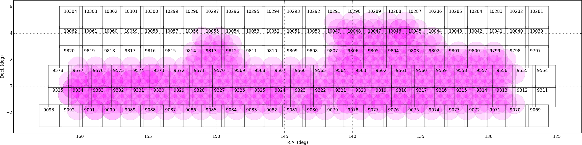
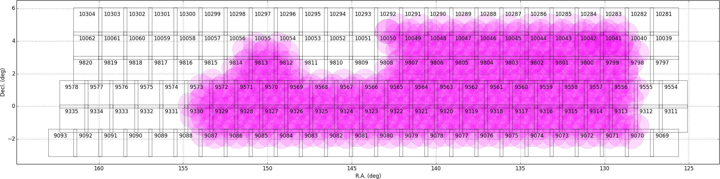
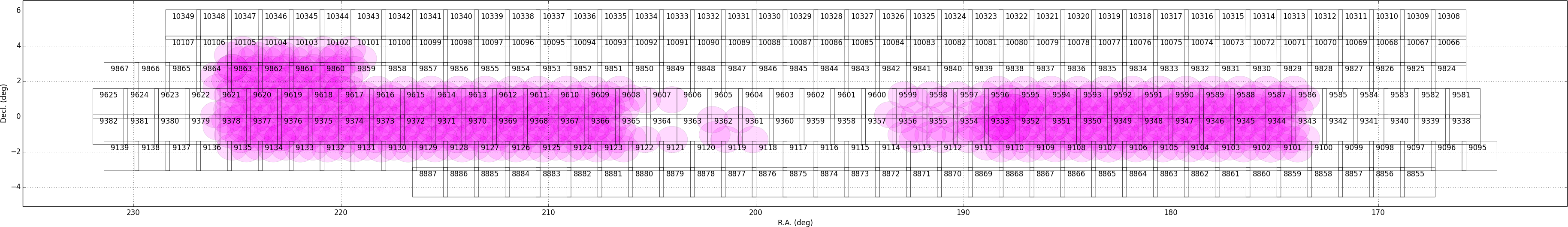
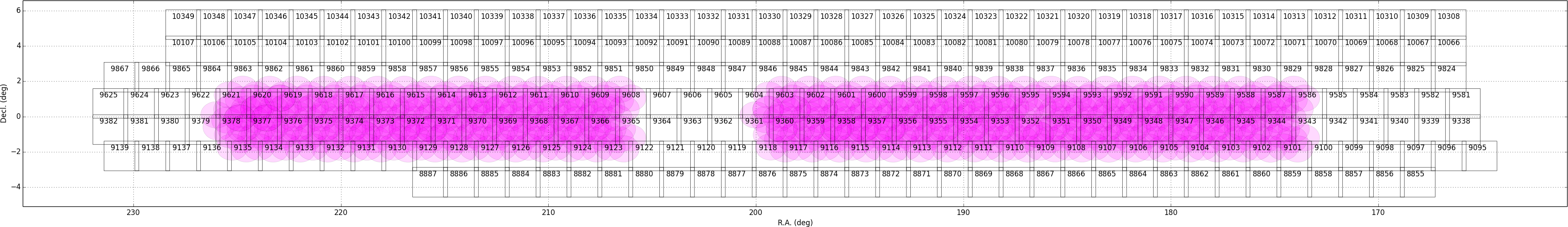
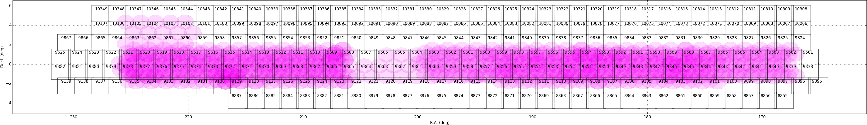
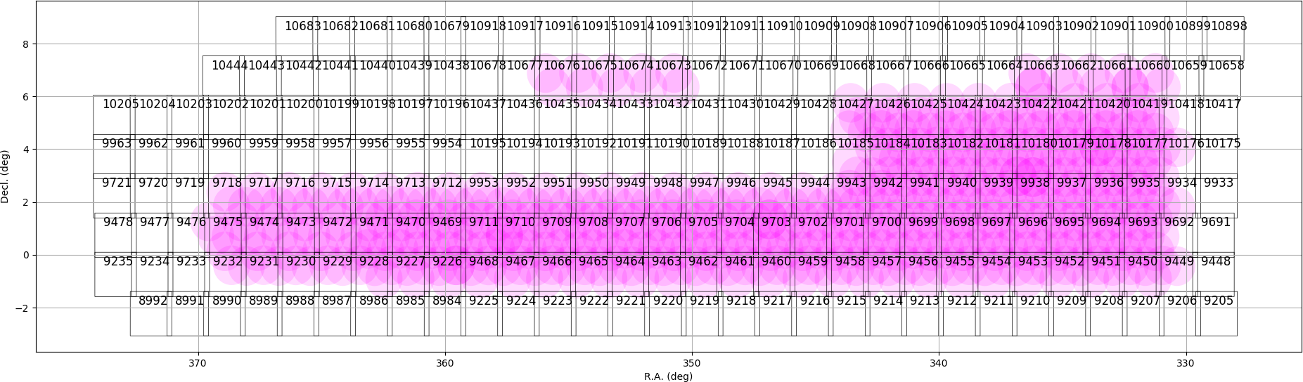
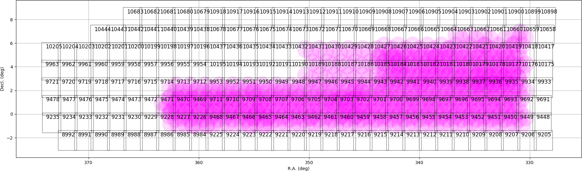
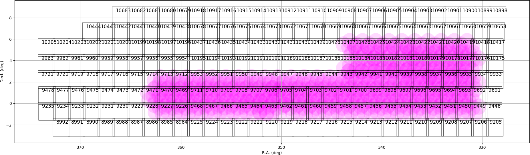
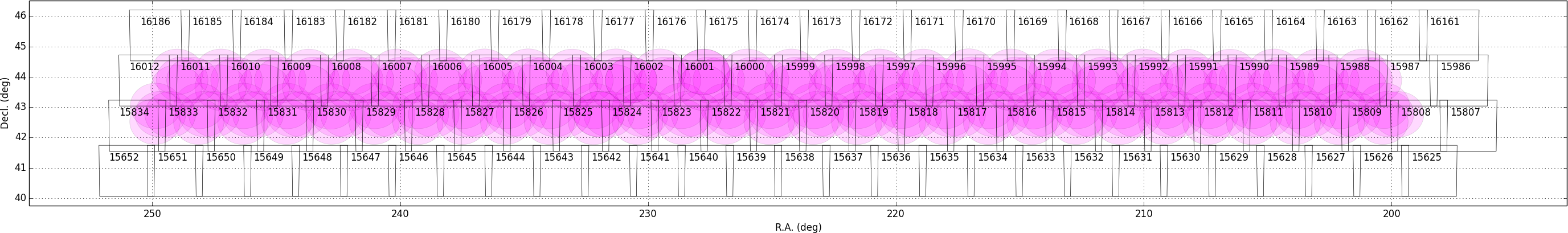
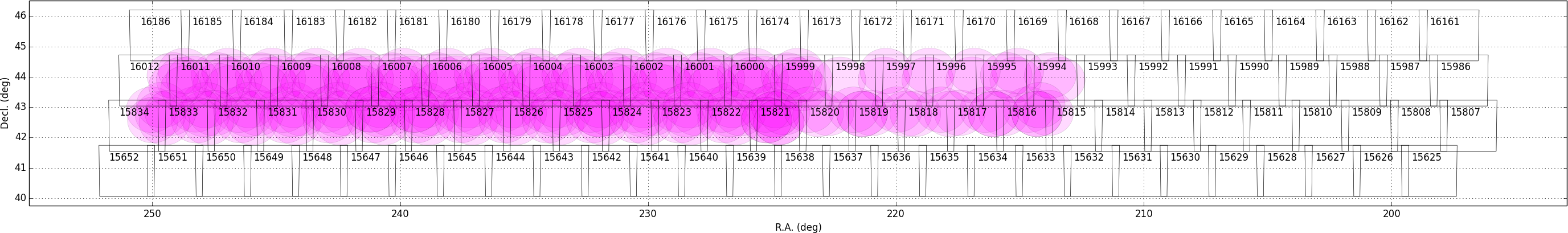
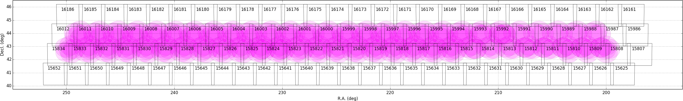
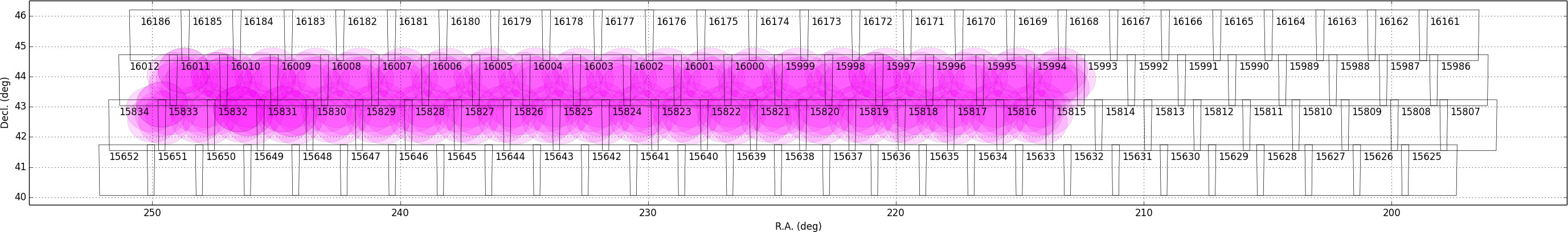
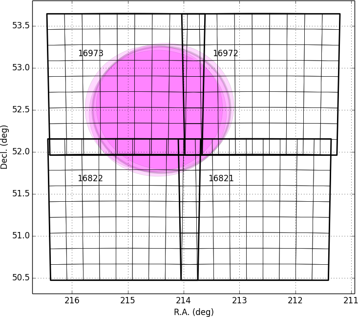
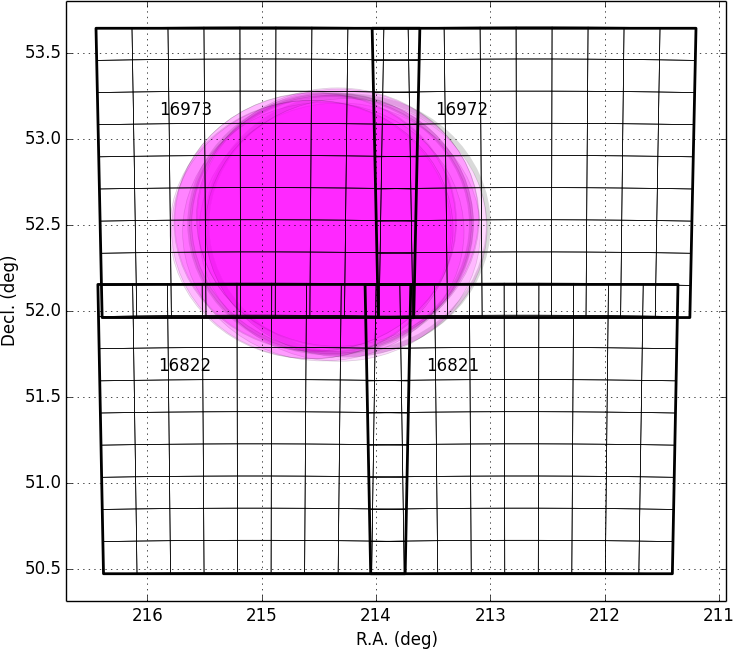
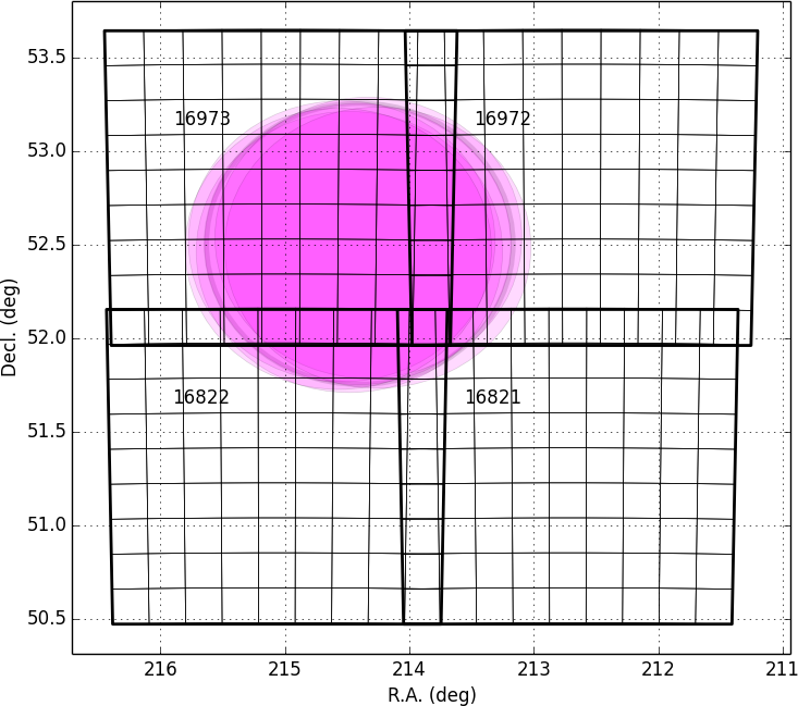
Tracts and Patches
The figures below are blow-ups of the coverage in each field for each filter. The large squares are tracts (approx. 1.7deg wide) and each tract is broken into 9×9 patches, each of which is 4200 pixels on a side. There is an overlap of 1 arcmin between the two adjacent tracts. Patches have an overlap of 200 pixels (~34 arcsec).
Deep & UltraDeep
| Field Name | HSC-g | HSC-r | HSC-i | HSC-z | HSC-Y | NB0921 | NB0816 | NB0387 |
|---|---|---|---|---|---|---|---|---|
| COSMOS | 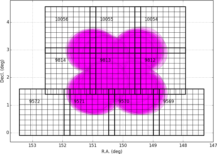 |
 |
 |
 |
 |
 |
 |
 |
| DEEP2-3 |  |
 |
 |
 |
 |
 |
 |
 |
| ELAIS-N1 |  |
 |
 |
 |
 |
 |
 |
 |
| SXDS+XMM-LSS |  |
 |
 |
 |
 |
 |
 |
 |
Wide
| Field Name | HSC-g | HSC-r | HSC-i | HSC-z | HSC-Y |
|---|---|---|---|---|---|
| W01 (WIDE01H) |  |
 |
 |
 |
 |
| W02 (XMM) | 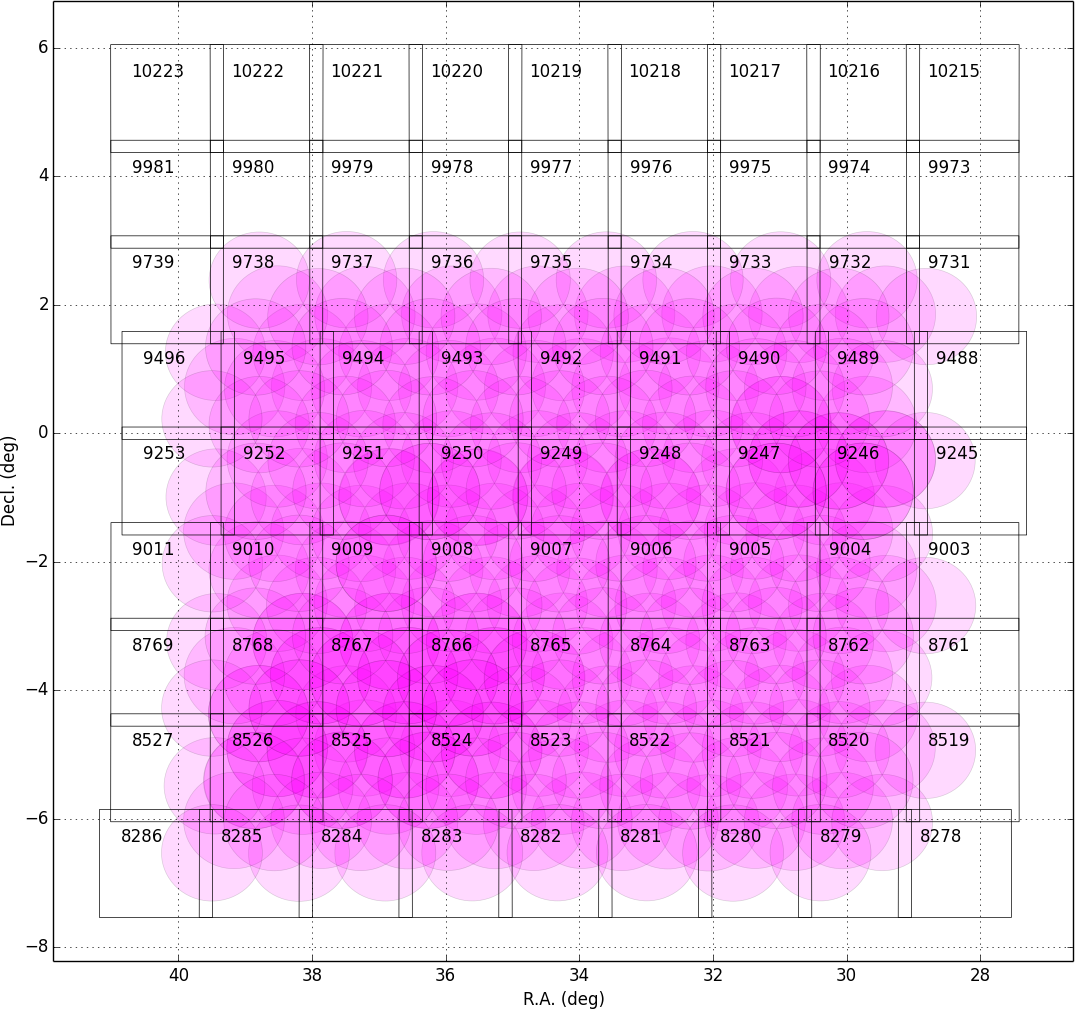 |
 |
 |
 |
 |
| W03 (GAMA09H) |  |
 |
 |
 |
 |
| W04 (WIDE12H+GAMA15H) | 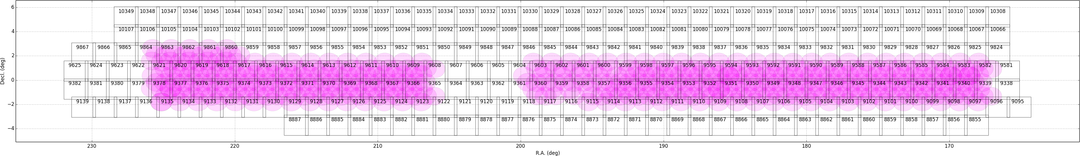 |
 |
 |
 |
 |
| W05 (VVDS) | 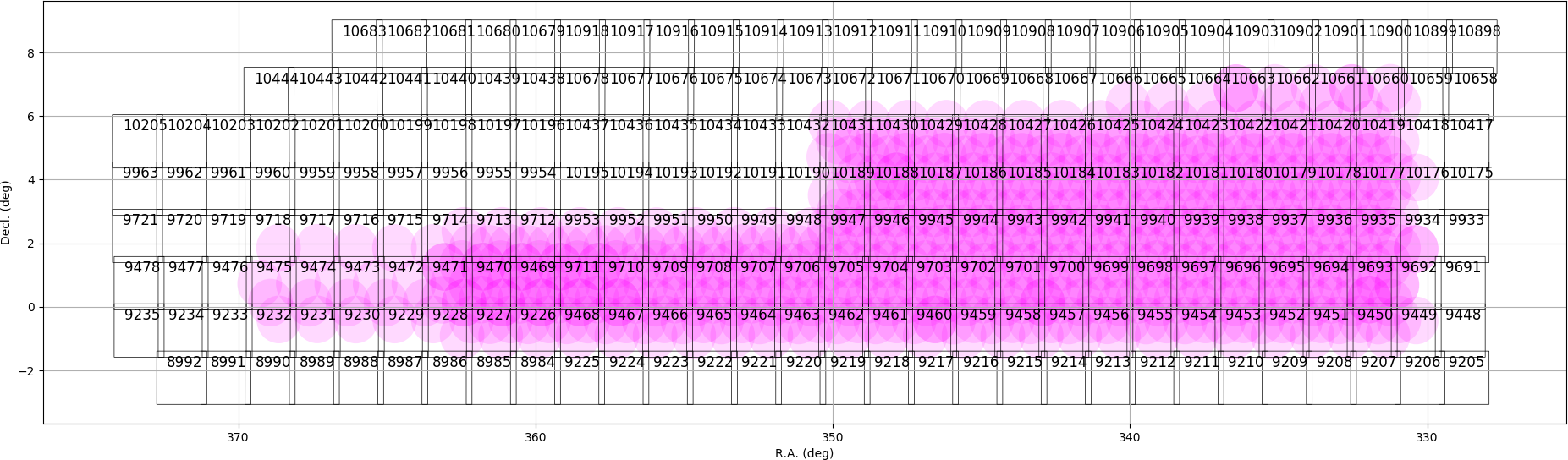 |
 |
 |
 |
 |
| W06 (HECTOMAP) | 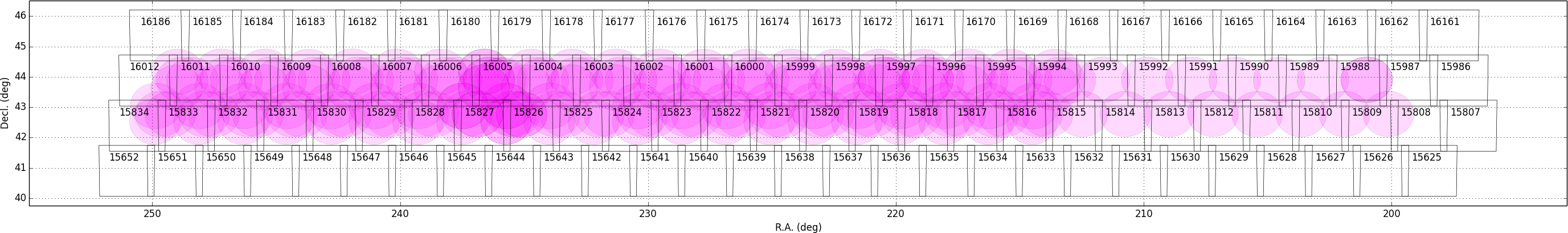 |
 |
 |
 |
 |
| W07 (AEGIS) | 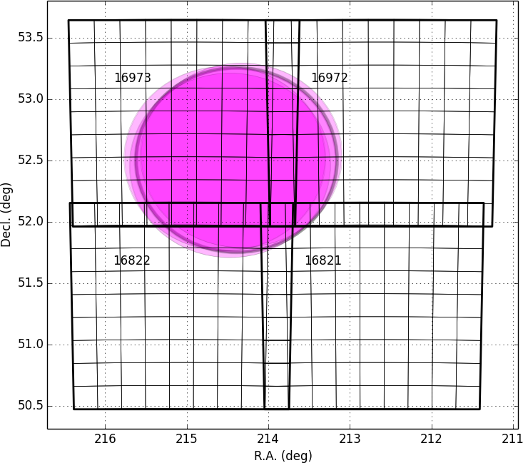 |
 |
 |
 |
 |
The files below give the exact celestial coordinates of each tract and patch.
- Deep & UltraDeep
- Wide